If you’ve ever seen breathtaking aerial shots in real estate listings, precise mapping data for infrastructure projects, or thermal scans of solar farms, there’s a good chance drone and image services were behind it.
These services combine drone technology with advanced imaging and data processing to deliver high-resolution visuals, accurate maps, and actionable insights across industries.
From construction site monitoring to industrial solar installation inspections and asset management, drones are changing the way businesses collect, process, and use data.
What Are Drone and Image Services?
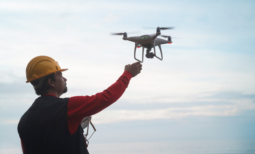
In simple terms, drone and image services involve using unmanned aerial vehicles (UAVs) equipped with high-resolution cameras or specialized sensors to capture images and videos from the air.
These images are then processed to produce detailed maps, 3D models, inspection reports, or marketing visuals.
Modern drone solutions can also include thermal cameras, LiDAR sensors, and multispectral imaging for advanced analysis in sectors like agriculture, energy, and infrastructure.
Key Components of Drone and Image Services
1. Data Acquisition
- Aerial Photography & Videography: Capture high-resolution images and cinematic aerial videos for industries like real estate, tourism, and media.
- Drone Surveys: Use photogrammetry and LiDAR to create accurate topographical maps and 3D models.
- Thermal Imaging: Detect heat signatures for infrastructure inspections, solar panel maintenance, and energy audits.
2. Data Processing
- Photogrammetry: Convert images into 3D models, orthomosaics, and contour maps.
- Geospatial Analysis: Extract details like elevation, vegetation health, and volumetric measurements.
- Image Enhancement: Edit and improve captured visuals for marketing or reporting.
3. Deliverables
- Orthophotos and topographic maps
- 3D building or terrain models
- Progress monitoring videos
- Inspection reports with defect detection
Applications Across Industries
- Construction & Infrastructure: Drones track construction progress, inspect bridges or towers, and generate survey mapping data without disrupting on-site work.
- Agriculture: Multispectral sensors measure crop health, irrigation efficiency, and soil conditions, enabling precision farming.
- Renewable Energy: Solar farms and wind turbines benefit from drone inspection to detect faults, dirt accumulation, or shading issues—especially helpful for large-scale solar panel installation monitoring.
- Real Estate: Aerial views showcase property layouts, surroundings, and landscapes, making listings more appealing.
- Industrial Asset Management: Regular aerial checks improve safety, reduce downtime, and extend equipment life.
Benefits of Drone and Image Services
- Cost-Efficient: Reduces the need for cranes, helicopters, or manual surveying.
- Time-Saving: Large areas can be surveyed in hours instead of days.
- High Accuracy: Centimeter-level accuracy for mapping and measurements.
- Safety: Inspects dangerous or hard-to-reach areas without putting workers at risk.
- Versatility: A single drone flight can capture data for various applications.
How to Choose the Right Drone and Image Services Provider
When searching for reliable drone services, consider:
- Licensing & Compliance: Ensure that the service provider adheres to DGCA regulations in India.
- Experience: Look for case studies or past projects in your industry.
- Equipment: Advanced drones with high-resolution and thermal cameras offer better results.
- Data Processing Capabilities: Providers should offer post-processing, analysis, and easy data access.
- Customer Support: From planning to delivery, communication is key.
Interlink Opportunities
- Learn more about solar companies Chandigarh for renewable energy solutions.
- Check our guide on affordable solar panels for cost-effective installations.
- Discover industrial solar installation for factories and large facilities.
- Explore solar panels for home to power your household efficiently.
- Understand home solar installation cost before making a purchase.
- Find details on solar panel installation for various property types.
FAQs
Q1: Can drones capture both photos and videos?
Yes, most professional drones can capture high-resolution images and 4K or higher videos.
Q2: Are drone inspections safe?
Absolutely—drones reduce the need for risky manual inspections, keeping workers safe.
Q3: How fast can drone data be delivered?
Basic aerial photography can be delivered within hours, while processed survey data may take a few days.
Q4: Can drones operate in adverse weather?
Light rain or high winds can affect flight safety and image quality, so conditions must be suitable.
Q5: What is the range of a commercial drone?
Some commercial drones can fly between 5 and 10 kilometers on a single battery charge, depending on the model.
Q6: How do drones help in renewable energy?
They inspect solar panels, wind turbines, and other renewable infrastructure to detect faults early.
Q7: Is drone survey data accurate enough for engineering projects?
Yes, with proper equipment and calibration, drones can achieve centimeter-level accuracy.
Q8: Can drones be used indoors?
Yes, smaller drones can be used for indoor inspections, provided the space allows safe maneuvering.
Q9: Do drone services require special software?
Yes, processing tools like Pix4D or DroneDeploy are often used for mapping and 3D modeling.
Q10: What should I look for in a drone service provider?
You should look for experience, certifications, advanced equipment, and strong customer reviews in a drone service provider.
Conclusion: Elevating Possibilities with Drone and Image Services
From construction sites and agricultural fields to solar farms and real estate marketing, drone and image services are reshaping how industries capture, process, and use visual data. They offer unmatched speed, accuracy, and safety compared to traditional methods—delivering results that are both cost-effective and visually stunning.
As technology continues to advance, drones will only become more versatile, integrating with AI and analytics to provide even more profound insights. Whether your goal is to inspect, survey, market, or analyze, partnering with an experienced and compliant drone service provider ensures you get the most out of this powerful technology.
The sky isn’t the limit anymore—it’s just the starting point.