The rise of advanced UAVs has completely transformed the way industries inspect critical assets. Instead of sending workers into hazardous environments, climbing towers, or shutting down operations, businesses now rely on drone inspection services to capture high-resolution data safely, quickly, and cost-effectively. From thermal imaging and tower inspection to 3D modeling and aerial visual inspections, drones are now an essential part of modern maintenance and asset management workflows.
Whether you’re in construction, energy, infrastructure, mining, or agriculture, understanding how drone inspection services work—and why they offer such massive benefits—will help you make smarter operational decisions.
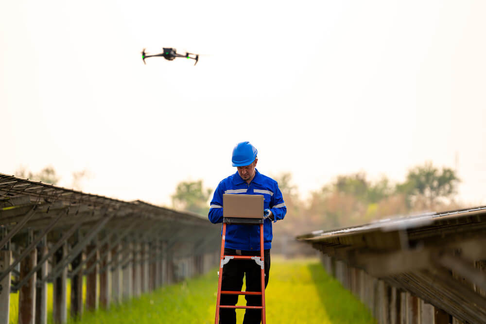
What Are Drone Inspection Services?
Drone inspection services use Unmanned Aerial Vehicles (UAVs) equipped with high-resolution cameras, thermal sensors, and mapping tools to perform safe, efficient, and detailed inspections of industrial assets such as power lines, wind turbines, bridges, pipelines, and buildings. These services reduce human risk, lower inspection costs, and deliver high-quality data including photos, videos, 3D models, thermal maps, and inspection reports for better maintenance planning.
Drones enable:
- Risk-free access to hazardous or high-altitude areas
- Faster data collection compared to manual inspections
- High-quality imagery for structural analysis
- Accurate thermal imaging for leak or heat anomaly detection
- Digital reporting for asset management
As industries move toward automation and predictive maintenance, drone inspection services are becoming the standard.
Key Applications of Drone Inspection Services
Industries use drone technology for a wide variety of inspection tasks. Here are the most important applications:
1. Infrastructure Inspections
Drones can capture detailed visuals and thermal data from structures such as:
- Bridges
- Railways
- Power lines
- Transmission towers
- Substations
- Chimneys
- Roofs
- Pipelines
High-resolution cameras allow for precise visual inspections, while LiDAR and photogrammetry enable accurate 3D modeling and deformation analysis.
Drones are especially useful for tower inspection and power line assessment, where traditional manual inspections are extremely risky.
2. Energy Sector Inspections
Wind Turbine Inspection
Drones capture:
- Blade cracks
- Erosion patterns
- Lightning damage
- Surface defects
They drastically reduce downtime and ensure personnel’s safety by avoiding climbs.
Solar Panel Inspection
Thermal imaging helps detect:
- Hotspots
- Cracks
- Dead cells
- Wiring issues
This is especially relevant considering modern solar energy panels price trends and maintenance needs.
Oil & Gas
UAVs help inspect:
- Flare stacks
- Offshore rigs
- Pipelines
- Gas leaks (via thermal or gas sensors)
These inspections ensure the safety of workers by eliminating exposure to hazardous environments.
3. Construction & Real Estate
Construction:
Drones are used for:
- Site surveys
- Progress tracking
- Stockpile measurement
- Safety monitoring
- Orthomosaic mapping
- Drone 3D mapping
- With drone 3D mapping, contractors get centimeter-level accuracy for planning and reporting.
Real Estate:
High-quality drone aerial photography delivers:
- Stunning visual property tours
- Landscape overviews
- Marketing-ready promotional content
4. Agriculture & Environmental Monitoring
Modern farms rely on drone imagery and multispectral sensors to monitor:
- Crop health
- Soil conditions
- Water stress
- Pest or disease impact
Thermal, RGB, and multispectral drones help farmers optimize irrigation and predict yield outcomes.
Environmental agencies use drones for:
- Wildlife tracking
- Flood assessment
- Fire detection
- Water body monitoring
5. Mining & Industrial Sites
Drone inspection services support mining operations with:
- Volumetric measurements
- Haul road optimization
- Blast site analysis
- Compliance documentation
- High-precision data collection
Using drones increases safety by reducing the need for workers to enter dangerous areas.
How Drone Inspection Services Work (Step-by-Step Process)
Understanding the workflow helps industries appreciate the precision and reliability of drone inspections.
1. Planning & Site Assessment
Drone pilots review:
- Airspace restrictions
- Asset accessibility
- Safety risks
- Weather conditions
Accurate planning ensures complete and compliant data collection.
2. Data Capture with UAVs
Depending on the requirement, drones use:
- RGB high-resolution cameras
- Thermal imaging sensors
- Multispectral cameras
- LiDAR scanners
The UAV performs systematic flights to capture:
- High-quality images
- Real-time videos
- Heat signatures
- Structural details
3. Data Processing & Analysis
Advanced software generates:
- Orthomosaic maps
- 3D models
- Point clouds
- Thermal maps
- Inspection reports
AI-driven defect detection can identify cracks, corrosion, hotspots, and deformities.
4. Reporting & Insights
Clients receive:
- High-quality photos and videos
- Interactive dashboards
- Severity-based defect maps
- Full inspection reports
- Maintenance recommendations
This structured reporting improves decision-making for power plants, construction sites, utilities, and more.
Benefits of Drone Inspection Services
The advantages go beyond cost savings.
1. Enhanced Safety
Drones eliminate the need for:
- Climbing tall structures
- Entering confined spaces
- Working near high-voltage lines
- Inspecting unstable surfaces
This reduces the risk of accidents and ensures regulatory compliance.
2. Cost-Effective
Drone inspections are:
- Faster
- Require less manpower
- Reduce equipment rental costs
- Minimize downtime
They deliver significant ROI, especially for large infrastructure or energy assets.
3. High-Quality, Accurate Data
UAVs generate:
- Ultra-detailed images
- Precision measurements
- Thermal imaging analysis
- 3D digital twins
These visual inspections are often more reliable than human assessments.
4. Faster Turnaround
Traditional inspections may take hours or days.
Drone inspection services deliver:
- Rapid data capture
- Automated reporting
- Faster maintenance workflows
This speed is especially beneficial for renewable energy industries tracking solar pv panels price or maintaining high-output solar farms.
5. Access to Hard-to-Reach Areas
Drones can safely inspect:
- Confined spaces
- Towers
- Tunnels
- Chimneys
- Under-bridge surfaces
- Offshore platforms
This avoids human exposure to hazardous conditions.
Drone Technology Behind Professional Inspections
Modern drone services rely on:
- UAVs with long flight times
- RTK-enabled positioning systems
- Collision-avoidance sensors
- Thermal imaging payloads
- High-resolution cameras (zoom capability)
- LiDAR scanners
- AI defect detection tools
Professional drone pilots ensure compliant, safe, and high-quality data collection.
Industries That Benefit Most from Drone Inspection Services
- Energy—wind, solar, oil & gas
- Infrastructure—bridges, towers, railways
- Utilities—power lines, substations
- Construction – mapping, monitoring
- Agriculture – crop and soil assessments
- Mining – volumetric surveys
- Real Estate – drone aerial photography
- Environmental Agencies—land and wildlife monitoring
These industries rely heavily on drone inspection to ensure precision, safety, and efficiency.
10 People Also Ask + FAQs
- What are drone inspection services?
They are UAV-based inspections that use cameras and sensors to assess infrastructure, energy sites, buildings, and industrial assets. - What industries use drone inspections?
These industries include energy, construction, infrastructure, agriculture, mining, utilities, and real estate. - Why are drone inspections better than manual inspections?
They are safer, faster, cheaper, and provide high-quality data. - Can drones inspect power lines?
Yes, UAVs perform power line inspections using thermal and high-resolution cameras. - How accurate is drone data?
With RTK and LiDAR, accuracy can reach centimeter-level precision. - What sensors do inspection drones use?
The sensors used by inspection drones include RGB, thermal, multispectral, LiDAR, and zoom cameras. - Do drones work for confined spaces?
Yes, specialized UAVs can safely inspect confined spaces without risking human entry. - Are drone inspections useful for solar farms?
Absolutely—they detect hotspots, damage, and efficiency issues in solar panels, helping optimize solar energy for home installations and large solar farms. - How long does a drone inspection take?
Most inspections are completed within minutes to a few hours. - What is the cost of drone inspection services?
Pricing varies by asset type, area size, and sensor requirements.
Conclusion
As industries adopt digital transformation and automation, drone inspection services have emerged as a game-changing solution for modern asset management. With high-resolution cameras, thermal imaging, 3D modeling, and advanced UAV technology, drones deliver unparalleled efficiency, safety, and data accuracy.
Whether you’re optimizing solar farms (with insights into solar energy panels price and maintenance), conducting drone 3D mapping for construction, or using drone imagery for infrastructure assessments, drone inspection services offer a smarter, faster, and safer way to understand your assets.