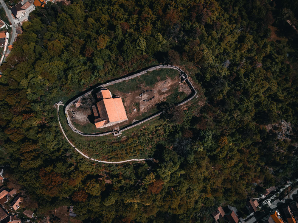
Ever wondered how surveyors create precise 3D maps of cities, landscapes, or construction sites—without setting foot on the ground? The answer lies in aerial photogrammetry. This technique uses photographs taken from aircraft, drones, or satellites to create accurate 3D models, maps, and measurements of the Earth’s surface.
Unlike simple aerial photography, aerial photogrammetry combines multiple overlapping images with advanced software to deliver measurable, data-rich results. This makes it indispensable in industries like construction, mining, agriculture, disaster management, and urban planning.
In this blog, we’ll break down what aerial photogrammetry is, how it works, its applications, its advantages, and how it compares to other technologies like LiDAR.
What Is Aerial Photogrammetry?
Aerial photogrammetry is the science of obtaining measurements, 3D models, and maps from aerial photographs. These photos can be captured using manned aircraft, satellites, or increasingly, unmanned aerial vehicles (UAVs), also known as drones.
By taking multiple overlapping images (called stereo pairs) from different perspectives, specialized software calculates depth and geometry. This process transforms 2D images into 3D models with accurate coordinates, elevations, and distances.
In short: aerial photography gives you a picture. Aerial photogrammetry gives you data you can measure.
How Aerial Photogrammetry Works
1. Image Acquisition
- Platforms: Aircraft, drones, or satellites capture vertical photographs (straight-down views) or oblique aerial photographs (angled views).
- Sensors: Cameras or LiDAR sensors collect high-resolution images, sometimes with multispectral or thermal data.
2. Overlap and Stereo Imaging
To calculate depth, images must overlap by 60–80%. This overlap allows stereoscopic viewing, giving software the ability to perceive depth and create 3D reconstructions.
3. Data Processing
- Images are stitched together using aerial triangulation.
- Ground control points (GCPs) and GPS data improve accuracy.
- Software generates orthophotos (geometrically corrected aerial images) and 3D point clouds.
4. Final Outputs
- Orthomosaic maps
- Digital Elevation Models (DEM/DSM)
- 3D city or terrain models
- GIS-ready layers for engineering or planning
Types of Aerial Photogrammetry
Vertical Photogrammetry
- The camera’s axis is perpendicular to the ground.
- This method yields maps and precise measurements of scale.
- It is widely used in urban planning and topographic surveys.
Oblique Photogrammetry
- Camera is tilted at an angle.
- Provides perspective and side views of features.
- Useful in architecture, archaeology, and real estate visualization.
UAV/Drone-Based Photogrammetry
- Low-cost, high-flexibility option.
- Popular for construction monitoring, agriculture, and site inspections.
- Often paired with drone and image services for faster workflows.
Applications of Aerial Photogrammetry
Construction & Infrastructure
Create 3D as-built models
Monitor progress and calculate earthwork volumes
Urban Planning
Map cities and plan infrastructure projects
Evaluate rooftop solar potential for residential areas
Agriculture
Map fields and assess crop health
Plan irrigation systems
Mining & Quarrying
Track stockpiles
Plan safe excavation routes
Disaster Response & Environment
Map flood zones, landslides, or wildfire damage
Assist in drone thermal imaging for rescue missions
Energy & Utilities
Inspect power lines and pipelines
Support solar energy contractors during solar farm planning
Advantages of Aerial Photogrammetry
- High Accuracy: Centimeter-level precision with ground control points
- Cost-Effective: Cheaper than ground surveys for large areas
- Time-Saving: Covers vast areas quickly
- Accessible: UAVs make it easy to survey hard-to-reach terrain
- Versatile Outputs: From orthophotos to full 3D models
Aerial Photogrammetry vs LiDAR
While both create 3D models, they differ:
- Photogrammetry relies on visual images and is cheaper, widely available, and detailed.
- LiDAR uses laser scanning, works in low light or dense vegetation, but is pricier.
Choosing between them depends on the project—LiDAR for dense forests, photogrammetry for urban and open landscapes.
Cost of Aerial Photogrammetry Services
The cost depends on:
- Survey area size (per sq. km or acre)
- Resolution required (higher accuracy = higher cost)
- Platform used (drone vs. aircraft)
- Processing software and deliverables
For small sites, drone-based aerial photogrammetry is often the most affordable solar panels of surveying methods—flexible, fast, and budget-friendly.
People Also Ask (FAQs)
1. What is aerial photogrammetry used for?
It’s used for mapping, 3D modeling, construction monitoring, agriculture, and disaster management.
2. How accurate is aerial photogrammetry?
With ground control points, it can achieve centimeter-level accuracy.
3. What is the difference between aerial photography and photogrammetry?
Aerial photography provides images, while photogrammetry converts those images into measurable 3D models.
4. Can drones do photogrammetry?
Yes, UAVs are widely used for photogrammetry due to their flexibility and affordability.
5. What are orthophotos?
Orthophotos are aerial images corrected for distortion, scale, and perspective, making them map-accurate.
6. Is LiDAR better than photogrammetry?
It depends. LiDAR works well in dense forests, while photogrammetry is cheaper and better for open landscapes.
7. What industries use photogrammetry most?
The industries that use photogrammetry the most include construction, mining, agriculture, urban planning, and environmental monitoring.
8. How much does aerial photogrammetry cost?
Costs vary, but drone surveys for small projects are usually more affordable than manned aircraft surveys.
9. What are vertical and oblique photographs?
Vertical photos are taken straight down, while oblique photos are angled, showing more perspective.
10. What software is used for photogrammetry?
Popular tools include Pix4D, Agisoft Metashape, and DJI Terra.
Final Thoughts
Aerial photogrammetry is transforming how we map, measure, and model the world around us. From construction sites to city planning, it delivers accurate, cost-effective, and detailed insights at scale.
With the rise of drones and improved processing software, the technology has become more accessible than ever. Whether you’re a surveyor, urban planner, or part of a solar panel manufacturer company in India looking to optimize installations, aerial photogrammetry opens up new possibilities.
If you’re planning your next big project, consider aerial photogrammetry—it could save you time, money, and effort while delivering results you can trust.
