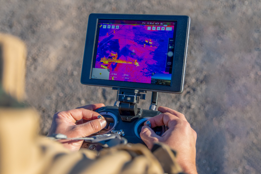
Drone thermal imaging is revolutionizing industries by providing real-time infrared data that the human eye simply cannot detect. Whether it’s search and rescue missions, industrial inspection, agriculture monitoring, or environmental safety, drones equipped with thermal cameras deliver accurate temperature measurement and high-resolution thermal data.
This guide explores how thermal drones work, their applications, and why they are becoming an essential tool for businesses, governments, and homeowners.
What is Drone Thermal Imaging?
Drone thermal imaging is the process of capturing temperature differences using drones equipped with infrared cameras. These specialized sensors detect infrared radiation and convert it into visible images known as thermograms. Unlike standard cameras that capture visible light, thermal drones can “see heat,” making them invaluable for inspections and safety operations.
- Infrared cameras capture heat signatures.
- Thermal imaging cameras measure temperature variations in real time.
- Advanced drones like DJI Matrice offer high-resolution images and frame rates for precise industrial applications.
How Does Drone Thermal Imaging Work?
- Infrared Radiation Detection – Every object emits heat. Thermal cameras detect this heat as infrared radiation.
- Conversion into Thermal Data – Microbolometers inside the camera transform radiation into electronic signals.
- Real-Time Visualization – Software converts signals into high-resolution thermal images or videos.
- Temperature Measurement – Operators can measure exact surface temperatures.
- Overlay with Visible Light – Many drones combine visible and thermal images for more accurate inspection.
Applications of Drone Thermal Imaging
1. Search and Rescue Missions
- Detect missing persons at night or through smoke, fog, and debris.
- Used by firefighters during wildfires to identify hotspots.
2. Industrial Inspection
- Power line and solar farm inspection.
- Detect electrical faults, insulation leaks, and equipment overheating without physical access.
- Faster and safer than manual inspection.
3. Agriculture Monitoring
- Analyze crop health and optimize irrigation.
- Detect plant stress, pest infestation, and soil moisture levels.
4. Construction and Real Estate
- Monitor building insulation, roof leaks, and structural integrity.
- Create thermal 3D mapping models for urban planning.
5. Environmental Protection
- Track wildlife movements at night.
- Detect illegal logging or poaching.
- Monitor air pollution and chemical leaks.
Benefits of Drone Thermal Imaging
- High Accuracy – Detects even slight variations in temperature.
- Real-Time Data – Immediate access to actionable insights.
- Safety – Drones can fly over hazardous or hard-to-reach areas.
- Cost Efficiency – Reduces labor costs and inspection time.
- Versatility – Useful in multiple industries (energy, defense, environment, agriculture).
Choosing the Right Thermal Drone
When selecting a thermal drone, consider:
- Thermal Resolution – Higher resolution offers more detailed data.
- Frame Rate – Essential for fast-moving inspections.
- Dual Camera Payloads – Combine thermal and visible light cameras.
- Battery Life – Longer flight time means more coverage.
- Software Integration – Ensure compatibility with drone and image services software.
Future of Drone Thermal Imaging
With AI integration, drones will soon analyze thermal data autonomously. From predictive maintenance in industries to smart city surveillance, the technology is evolving rapidly. Expect higher resolution cameras, longer flight times, and real-time cloud-based reporting.
Internal Linking
- Learn how Drone 3D Mapping is shaping urban planning.
- Discover Top Drone Service Providers in Chandigarh for expert solutions.
- Understand how Solar Electricity for Homes complements drone inspections for solar farms.
- Compare Solar Power Panels for Home and costs.
- Check out Solar Power to House solutions.
- Find expert Solar Energy Contractors near you.
- Explore premium SunPower Solar Panels.
FAQs
Q1. What is the range of a drone thermal imaging camera?
Most drones detect heat up to 300–500 meters, depending on the camera model.
Q2. Can thermal drones fly at night?
Yes, drones equipped with thermal imaging cameras are ideal for night operations.
Q3. Are thermal drones expensive?
Prices range from ₹2,00,000 to over ₹20,00,000, depending on resolution and features.
Q4. Can I use drone thermal imaging for solar panel inspection?
Absolutely! It identifies faulty cells, hotspots, and energy leaks in solar panels and cost analysis.
Q5. Do I need a license for thermal drones in India?
Yes, commercial use requires DGCA approval and drone pilot training.
Q6. Which drone is best for industrial inspection?
The DJI Matrice 300 RTK with Zenmuse H20T is highly recommended.
Q7. Can drone thermal imaging detect water leaks?
Yes, it can identify moisture retention and pipeline leaks.
Q8. What software is used for analyzing thermal drone data?
Popular tools include FLIR Tools, DJI Thermal Analysis Tool, and Pix4D.
Q9. How accurate is drone thermal imaging?
With proper calibration, drones achieve accuracy within ±2°C.
Q10. Can farmers benefit from drone thermal imaging?
Yes, it helps in crop monitoring, irrigation planning, and livestock tracking.
Final Thoughts
Drone thermal imaging is no longer just futuristic tech – it’s a practical solution shaping industries today. From rescue missions to solar inspections and agriculture monitoring, it provides real-time insights, safety, and efficiency. Investing in thermal drones means staying ahead in a world where data and technology drive smarter decisions.
